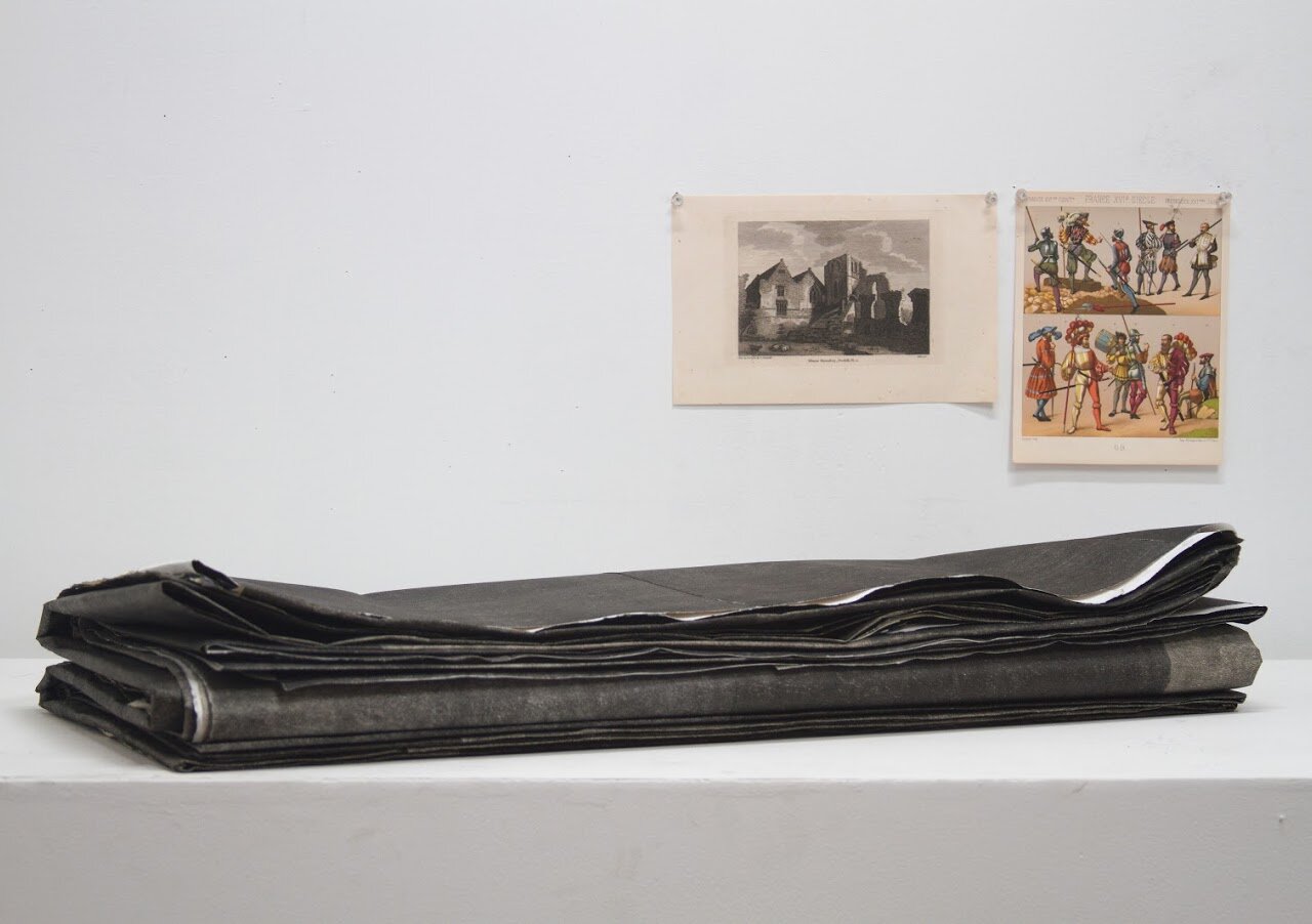
Covid Atlas (2020 - 2026)
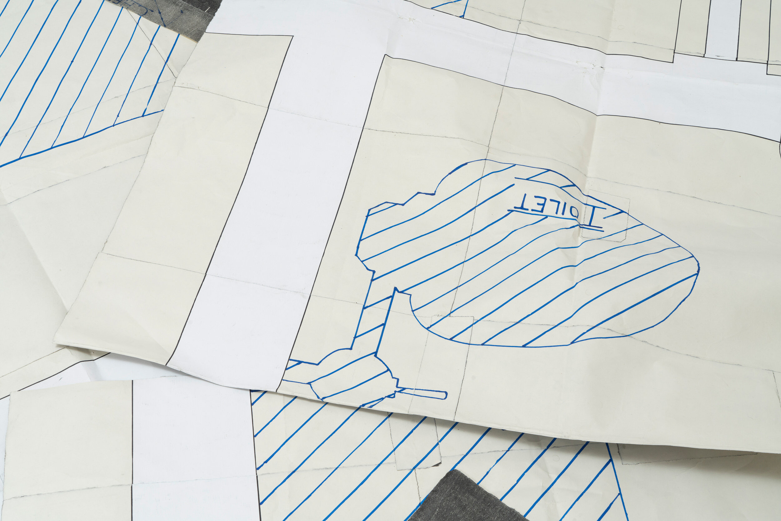
Graphite, permanent marker, acrylic, and woodcut on paper
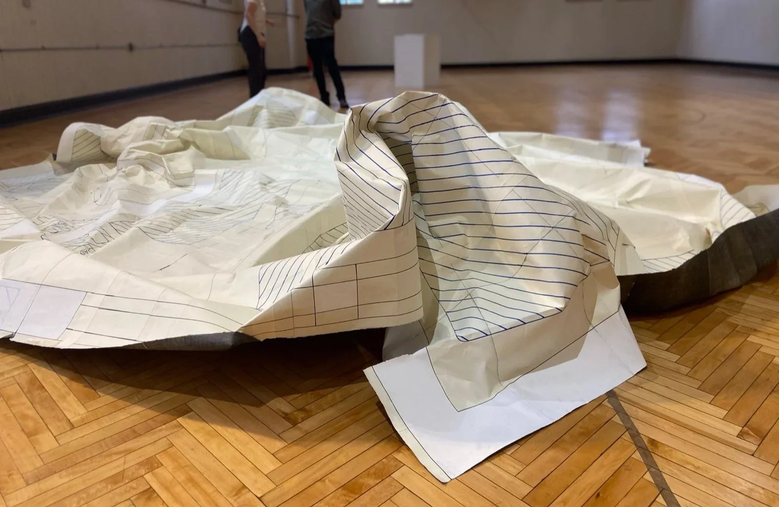
~1’ x ~3’ x ~8” when folded; ~20’ x ~20’ when unfurled
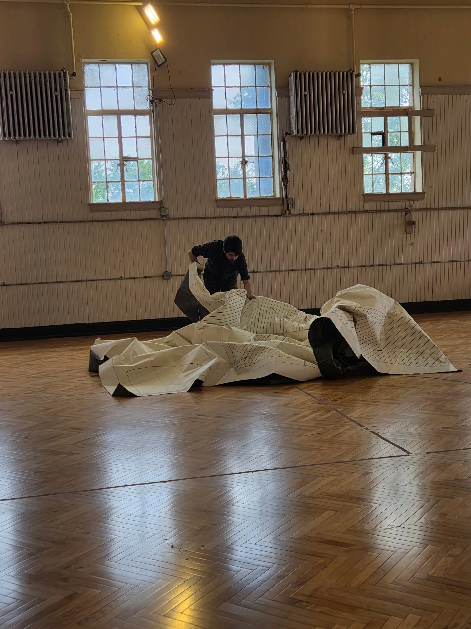
In one of my last studio visits with Pope.L, we were discussing Covid Atlas. The visit took place over Zoom during the height of the lockdown. Holding my laptop with two hands, I walked it around the room so he could see the work spread across the floor in strips.
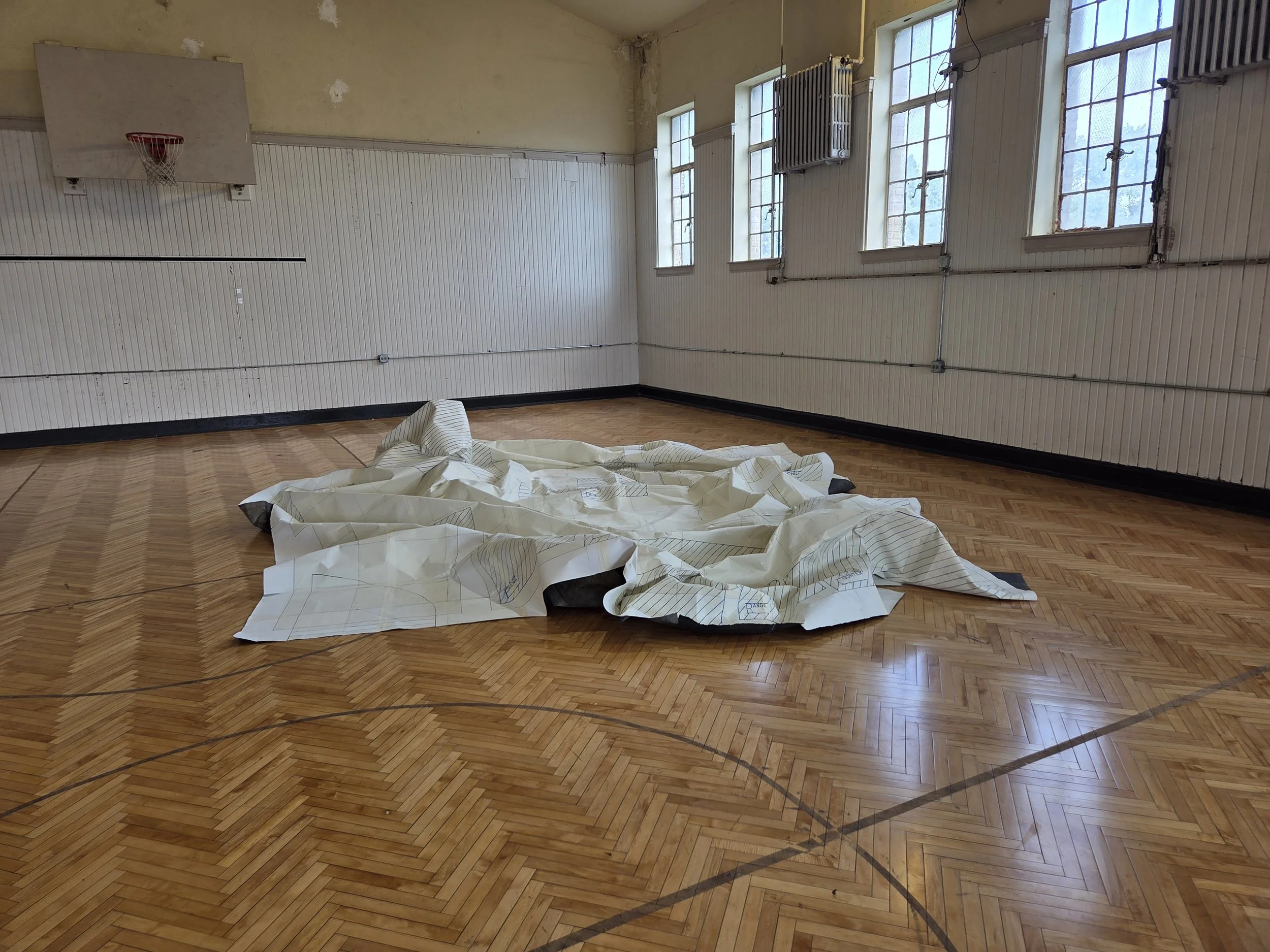
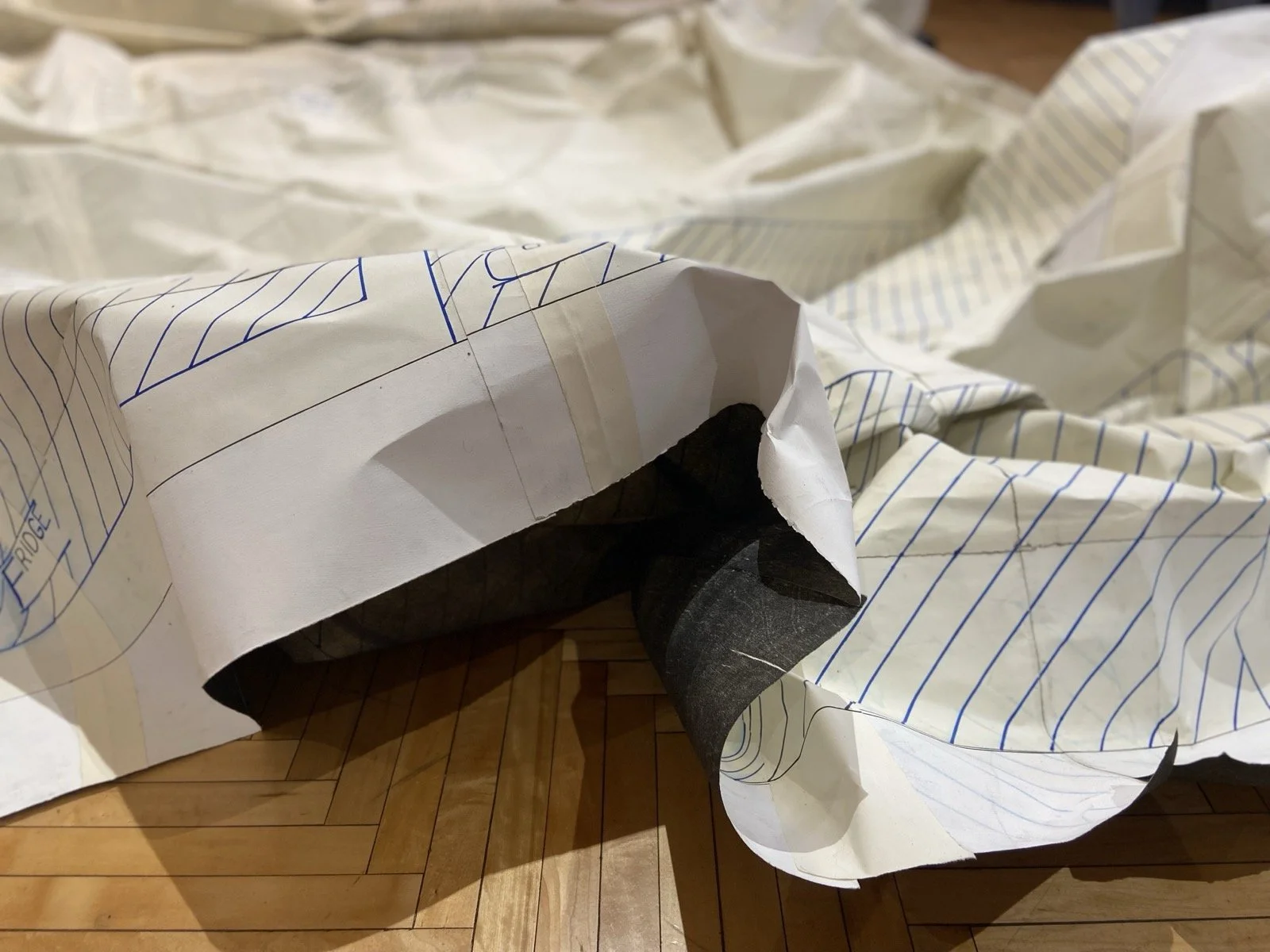
Covid Atlas is a 1:1 scale map of the studio apartment I lived in. It’s composed of hundreds of sub-sheets of buff paper. Walls are blocked in with chunky gesso and outlined in black marker. Furniture is labeled and striped in blue. Even then, still under construction, the map’s surface was a sea of dents, scuffs, and swirls of stray studio dust.
Pope.L had two suggestions.
*
The first concerned the title. In five years, he said, I would stop calling it Covid Atlas. It would simply be Atlas.
At the time, I understood this as a prediction about historical distance. The pandemic would recede, and the other concerns of my practice–concerns with archives and storage and mediation–would remain.
“Atlas” is a curious term for a map. It comes to us from Gerardus Mercator, whose Atlas was conceived not as a map of the world but as “cosmographical meditations upon the creation of the universe and the universe as created.” The Atlas to whom the title refers is not the Greek Titan burdened with the heavens, but a mythical king of Mauritania–a legendary philosopher, mathematician, and astronomer said to have fashioned the first celestial globe. Such globes place the Earth at the center, mapping the heavens to help visualize and solidify humanity’s place in an incomprehensibly vast sea of stars. “Scales,” as Zachary Horton writes, “are speculative: they define a field of view in which entities then become resolvable, often through technological mediation.” Rather than scaling up from the size of a map, an atlas scales down from the size of the whole universe.
Does Covid Atlas fulfill this remit? Under lockdown, my apartment had become an outsized chunk of my universe without changing in size. This is a kind of scalar shock, where it's not the size of things that has changed but your frame of reference. In insisting on 1:1 scale, the map preserves the apartment's static relationships–the distance from the sink to the bathtub. It is unclear whether it preserves that site’s shifting relationship to the world outside.
The “Covid” part of the title felt important for reasons beyond the lyric. I was less concerned with describing my affective experience of life under lockdown than with responding to the perceived historicity of that moment. There was a strong feeling in the air that the pandemic was a historically significant event, that we were living in an era. In the early months of the pandemic I was receiving a great deal of practical advice: work small, keep things manageable. It felt like this generic advice was responding more to the scalar shock of history than to any property of my work.
Still, Covid Atlas was a response to that advice, if a spiteful one. What was the largest thing I could make in the space that was available to me? Something that filled that space exactly.
And there were literary precedents I wanted to think through. Lewis Carroll writes of a map with a scale of “a mile to the mile,” so large that it has never been unfolded because farmers fear it will blot out the sun. Jorge Luis Borges later imagined a map the size of an empire. Long after that empire’s decline, the map’s fragments remained in the desert, where “animals and beggars” took shelter beneath them. These are stories of hubris and ruin, of the fundamental impossibility of producing a perfectly detailed representation.
These stories remind us that the map is not the territory. My question, however, is and remains “why not?” Maps peel away from the thing they depict and quickly become territories unto themselves, complete with their own distinct histories and impossibilities of re-representation.
*
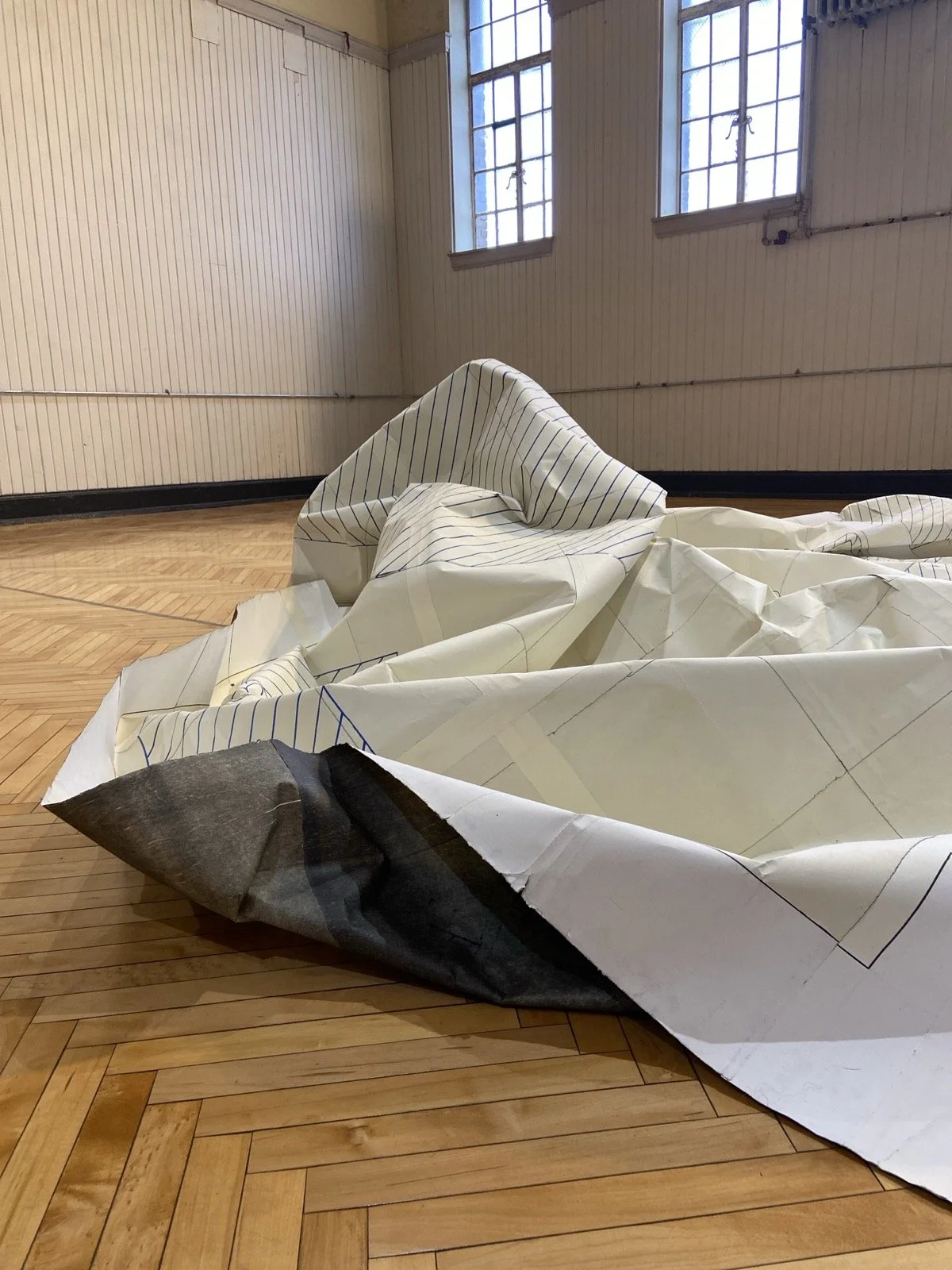
The second suggestion concerned the installation. Rather than carefully folding the work or arranging it on a pedestal, Pope.L said I should just crumple it into a ball. Let it settle into whatever form it assumed. Let the map be a piece of paper.
At the time, I had been imagining Covid Atlas splayed like an oversized road map. I would fold and unfold it into large but regular panels. It would probably never be fully unfurled for installation (especially not in a crowded group show like my thesis exhibition), but like a roadmap you have messily refolded, it could show enough of its surface area to give a sense of what lurked in its interior.
With that messiness in mind, I had selected the material for the map with an eye for wear and tear. Rives Lightweight is a workhorse bookmaking and proofing paper. It’s cheap, reasonably durable, readily available, and holds both ink and graphite well. It is, however, exceedingly soft and prone to showing every ding or scuff. Folding or unfolding the map would risk crumpling and tearing it under the stress of its own weight. I already knew that these points of fracture would define the work: I was looking for materials and installation strategies that pulled that deliberate fragility forward for the viewer.
In many ways, paper is more like a plant than a textile. It’s still alive. Even chemically treated cotton rag stocks like Rives Lightweight are made up of densely interlocked cellulose strands. When you make a sheet of paper, you chemically separate these strands by suspending them in water, then physically scoop them through a mold. As the water drains away, the cellulose strands reconnect to form the paper, bonding into fresh structures not unlike those of the plant from which they came. The way I was trained as a printmaker, you never cut a piece of paper, only tear it. This ensures that you preserve those tangled strands and the plant-like strength they provide.
Paper has memory. When you fold a sheet of paper, it leaves a crease–a mark of the process that remains even if the action is reversed. When you make a mark on paper, the only way to erase it is to abrade the surface away. Printmakers sign their work in pencil, pressing firmly so as to leave an indent that the paper will remember even if the graphite smudges away.
And so, Pope.L’s suggestion to let the map be a piece of paper seemed like a good one. Covid Atlas is and was fundamentally concerned with a type of physical storage. Maps do not fit neatly into a dichotomy between model and world, because they are objects in the world themselves. The paper that makes up the representation has its own material properties. Installing the work by balling it up and letting it relax stages those properties as not only constitutive of the map, but “autopoietic”–self-structuring and self-producing.
At the time I didn’t follow this advice. I’m trying it out here.
*
At the intersection of these two pieces of advice, something interesting about Covid Atlas emerges. Autopoiesis refers to a system capable of altering and maintaining itself by producing a border between the organism and the environment around it. Paper, in its plantness, is produced by a structure of cellulose walls. When you ball it up and it relaxes, the boundaries of its form express the specific reach of that structure as it plays across a surface.
The map, as a representation, is also concerned with that kind of play. If I returned to the actual apartment to unfurl the map today, it would not fit. Its dimensions exceed the walls of the space by about six inches and there are notable protrusions it would need to wrap around–a T-shaped wall separating the front door from the kitchen and the enclosed space of the bathroom. The map curls around and snags on the territory.
As I regard the map now in 2026, a year late by Pope.L’s proposed timeline, I can see how it curls around and snags on the problems of history and representation too. Covid Atlas stores two models of history. The first is the image or remnant of a time that felt historic–the scalar shock felt by myself and others in the beginning of the pandemic. The second is a narrative version of history since that time: a changelog of damage and repair. The map was cut into quarters during a deinstallation. It was damaged in a flood, then torn into strips to launder and dry. Most recently, it lay folded under a desk at my new job for about a year, before being patched, reassembled, and re-inked for this installation. All of this accumulates into a history that grows further from the original studio apartment by the day.
The map as we encounter it today, compels these two competing ideas of history to resolve into a single, viewable form. This is only possible because we are viewing the map in another historical moment and because the map is operating as a territory unto itself as materialized by its dings, tears, and patches.
And so is this a “cosmographic meditation” as Mercator would recognize it, something that explains the universe and how we fit into it?
An Atlas?